
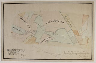
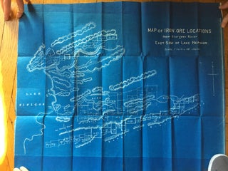
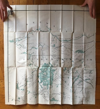
Map of Prairie and Timber Lands in Arkansas County
Stuttgart, Ar. The Free Press, [ca. 1900-1910]. Illustrated broadside and map, 15.5 x 10.25 inches. Old folds, some starting to separate along outer fold lines, minor toning and soiling. A few pencil and ink notations. An unrecorded promotional real estate and timber map of Arkansas County, Arkansas, illustrated with two..... More
![Item #2099 Map of Arkansas [caption title]. Arkansas, Fort Smith Lumber Company](https://mcbriderarebooks.cdn.bibliopolis.com/pictures/McBRB2099_01.jpg?width=320&height=427&fit=bounds&auto=webp&v=1624626684)
![Item #831 Arkansas Via Iron Mountain Route [cover title]. Arkansas, Missouri](https://mcbriderarebooks.cdn.bibliopolis.com/pictures/McBRB831_01.jpg?width=320&height=427&fit=bounds&auto=webp&v=1565781510)
![Item #2022 E-Z Guide Map of Los Angeles [cover title]. California](https://mcbriderarebooks.cdn.bibliopolis.com/pictures/McBRB2022_01.jpg?width=320&height=427&fit=bounds&auto=webp&v=1631198292)


![Item #2886 Map of the Shepard Ranch Santa Clara, Calif. [caption title]. California, Agriculture](https://mcbriderarebooks.cdn.bibliopolis.com/pictures/2886.jpg?width=320&height=427&fit=bounds&auto=webp&v=1749558496)

![Item #589 [Tunnel and Surface Map of Mineral Point Mine, near Osburn, Idaho]. Coeur D'Alene Mines...](https://mcbriderarebooks.cdn.bibliopolis.com/pictures/McBRB589_01.jpg?width=320&height=427&fit=bounds&auto=webp&v=1562188373)