![Item #589 [Tunnel and Surface Map of Mineral Point Mine, near Osburn, Idaho]. Coeur D'Alene Mines Corporation.](https://mcbriderarebooks.cdn.bibliopolis.com/pictures/McBRB589_01.jpg?width=768&height=1000&fit=bounds&auto=webp&v=1562188373)
![[Tunnel and Surface Map of Mineral Point Mine, near Osburn, Idaho]](https://mcbriderarebooks.cdn.bibliopolis.com/pictures/McBRB589_02.jpg?auto=webp&v=1562188373)
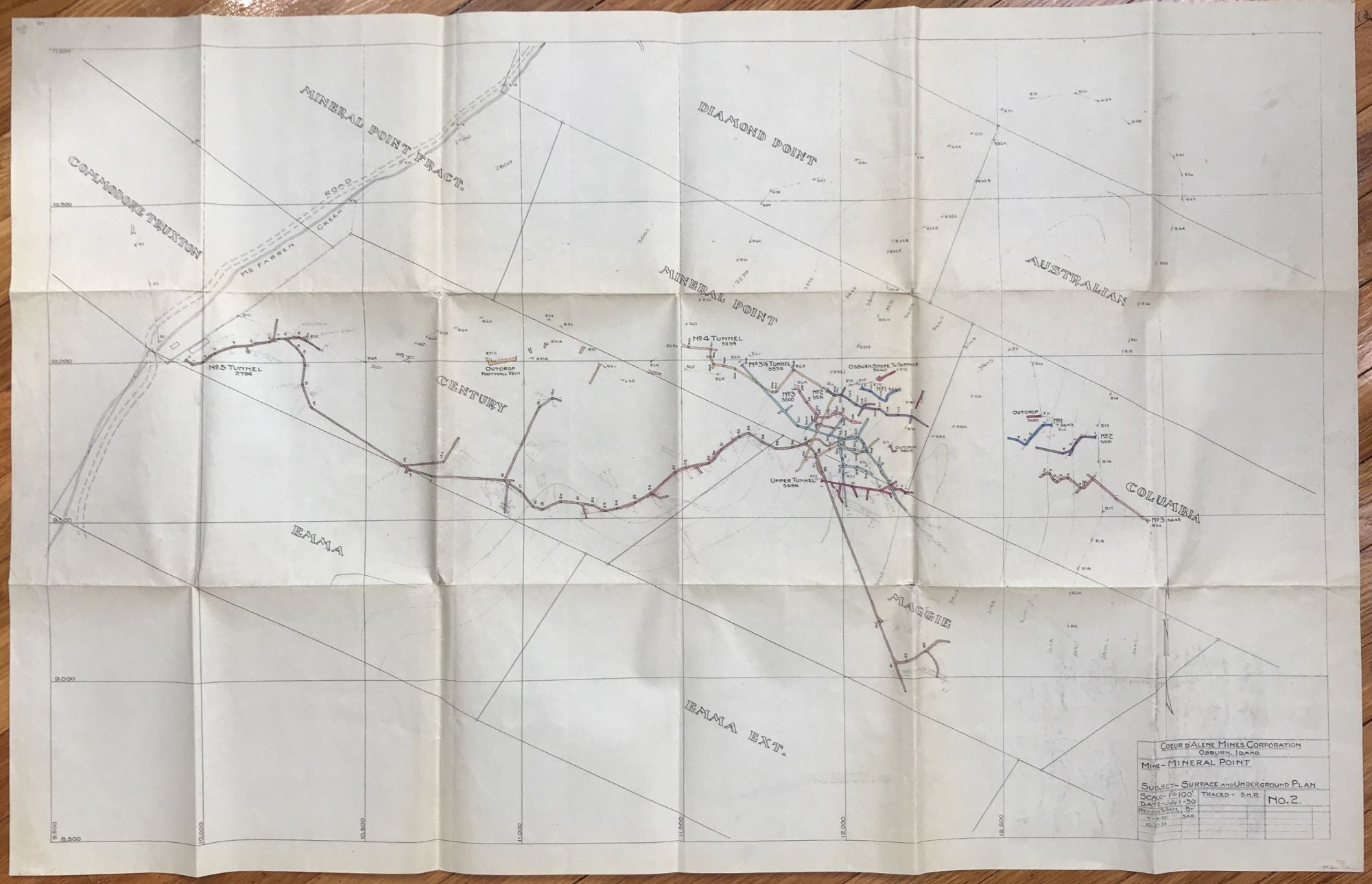
[Tunnel and Surface Map of Mineral Point Mine, near Osburn, Idaho]
Osburn, Id. 1930. Folding map, 27 x 42 inches. A couple of short separations along folds. Several contemporary pencil manuscript annotations. Light tanning and dust soiling. Very good. Item #589
Scarce map of tunnels and several surface constructions related to the Mineral Point mine in Osburn, Idaho, operated by the Coeur D'Alene Mines Corporation. The map dates to 1930, and illustrates the tunnel system and existing surface structures of the mine, colored in several different shades. The Coeur D'Alene Corporation was organized in 1928, and still exists today as the global corporation Coeur Mining, although it divested of its mining interests located near its namesake city in the early 2000s. This map therefore constitutes an important record of one of its earliest mining efforts.
Price: $375.00