![Item #2099 Map of Arkansas [caption title]. Arkansas, Fort Smith Lumber Company.](https://mcbriderarebooks.cdn.bibliopolis.com/pictures/McBRB2099_01.jpg?width=768&height=1000&fit=bounds&auto=webp&v=1624626684)
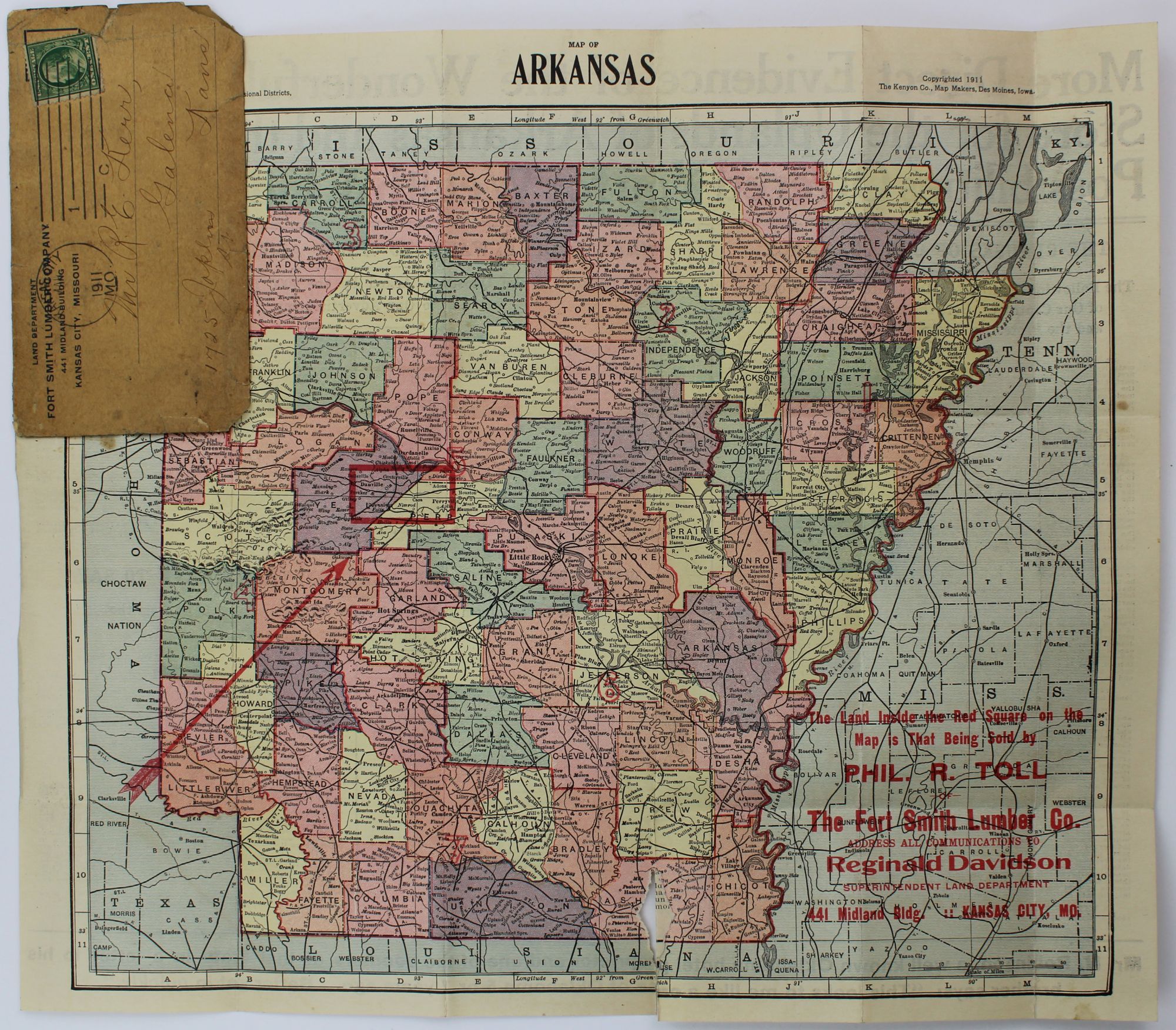
![Map of Arkansas [caption title]](https://mcbriderarebooks.cdn.bibliopolis.com/pictures/McBRB2099_02.jpg?auto=webp&v=1624626684)
Map of Arkansas [caption title]
Des Moines: Kenyon Map Company, 1911. Folding pocket map, 12.5 x 14.5 inches. Original printed card wrappers. Wraps somewhat worn and dust soiled, a with a few small chips at edges. Two separations along folds from lower edge, one with minor loss. Short closed tear from left edge at attachment to wrappers. Postmark and manuscript address on front cover; map overprinted in red. Good plus. Item #2099
An interesting cartographic advertisement for the Fort Smith Lumber Company, using a map of Arkansas by the Kenyon Map Company to promote its land sales in the state. The map is overprinted in red to highlight a tract of 35,000 acres being offered by the company at 15¢ per acre in Perry and Yell Counties, east of Fort Smith and to provide the information of the local agent, Philip R. Toll, and the head of the Land department at the Kansas City headquarters, Reginald Davidson. The verso prints extensive descriptions of the land, terms, and contract, as well as several testimonials, including one from an N. Robinson, who writes that, "This looks to me like a case of Oklahoma 5 or 7 years ago. Better get in quickly." The present copy was mailed to a potential investor in Joplin, Kansas; we locate no other examples of this map as an advertisement for Fort Smith Lumber Company or with the additional promotional text.
Price: $375.00