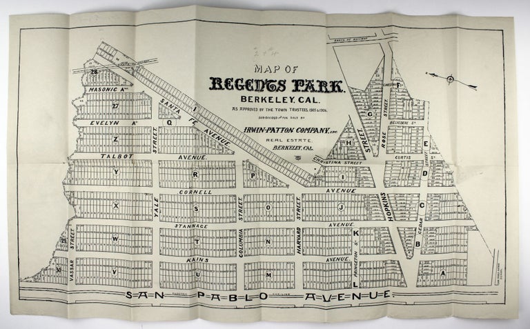
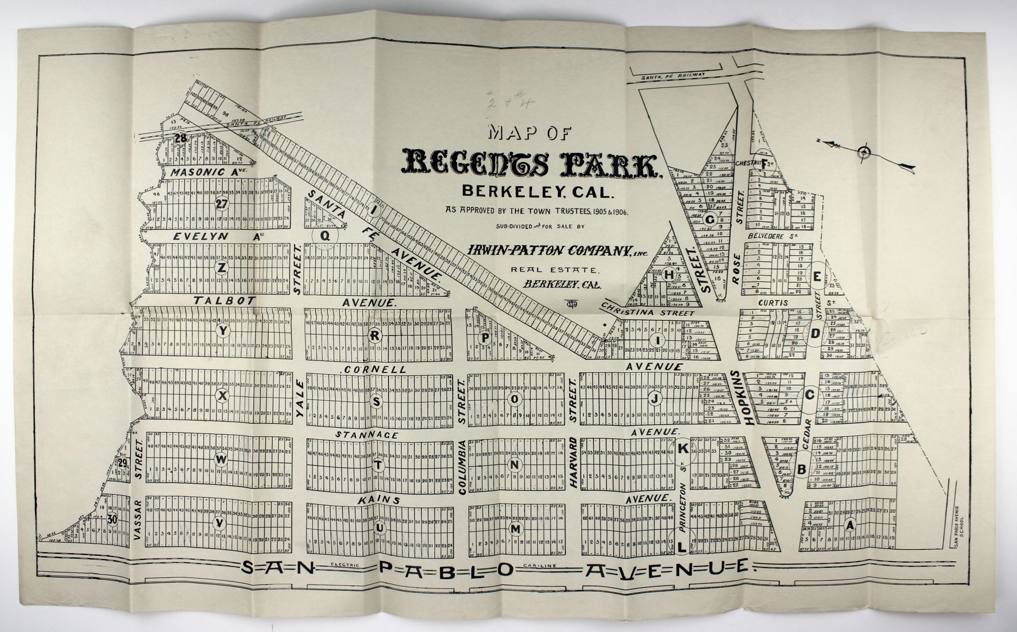
Map of Regents Park, Berkeley, Cal. As Approved by the Town Trustees, 1905 & 1906. Sub-Divided and for Sale by Irwin-Patton Company, Inc.
Berkeley: Irwin-Patton Company, [1907?]. Lithograph map, approximately 15 x 28 inches. Folded. Two contemporary manuscript annotations. Very minor wear at edges and faint toning; one small separation at fold point. Near fine. Item #2083
Large, early 20th-century real estate map showing a proposed subdivision on some thirty blocks in North Berkeley, now adjacent to University Village. The map is oriented with due north corresponding roughly to the left edge, with San Pablo Avenue at the bottom edge, Cedar and Hopkins Streets running vertically at right, Santa Fe Avenue running diagonally toward the upper left corner, and with a plethora of streets name after the Ivy League: Princeton, Harvard, Columbia, and Yale, with Cornell running perpendicular to them. Interestingly, while this area was developed roughly as delineated here, it is not exact, and many of the street names are also different (Yale Street is today's Gilman Street, for instance). Docketed in ink on the verso, "Regents Park #2 & #4". Not in OCLC.
Price: $975.00