![Item #159 Map of Iron Ore Locations Near Sturgeon River East Side of Lake Nepigon [caption title]. Canadian Mining.](https://mcbriderarebooks.cdn.bibliopolis.com/pictures/McBRB159.jpg?width=768&height=1000&fit=bounds&auto=webp&v=1544564745)
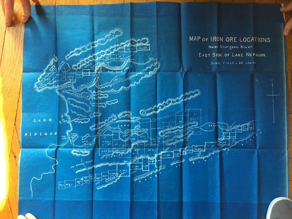
Map of Iron Ore Locations Near Sturgeon River East Side of Lake Nepigon [caption title].
[Toronto? ca. 1900]. Folding blueprint map, approximately 22 x 27 inches. Small perforation at lower right corner, not affecting map area. Very good. Item #159
Unrecorded large blueprint map of iron ore deposits between the east shore of Lake Nipigon and the Sturgeon River in Ontario, northwest of Thunder Bay. The map shows rectangular plots of surveyed land, locations of ore deposits, and important geological and mineral features. Efforts to mine this area intensified at the turn of the 20th century, when the Canadian government began to explore the development of natural resources in the vast northern regions of the province.
Price: $350.00
See all items by Canadian Mining