![Item #158 Rand, McNally & Co.'s Indexed Atlas of the World Map of British Columbia [caption title]. British Columbia.](https://mcbriderarebooks.cdn.bibliopolis.com/pictures/McBRB158_01.jpg?width=768&height=1000&fit=bounds&auto=webp&v=1544564745)
![Rand, McNally & Co.'s Indexed Atlas of the World Map of British Columbia [caption title]](https://mcbriderarebooks.cdn.bibliopolis.com/pictures/McBRB158_02.jpg?auto=webp&v=1544564745)
Rand, McNally & Co.'s Indexed Atlas of the World Map of British Columbia [caption title]
Chicago & New York: [1895]. [12]pp., with folding map measuring 14 x 21 inches. Original printed wrappers. Printed in black, red, and blue. Small portion of lower corner of front wrap chipped away. Light wear and minor soiling. Text evenly tanned, faint occasional foxing in map margins. Very good. Item #158
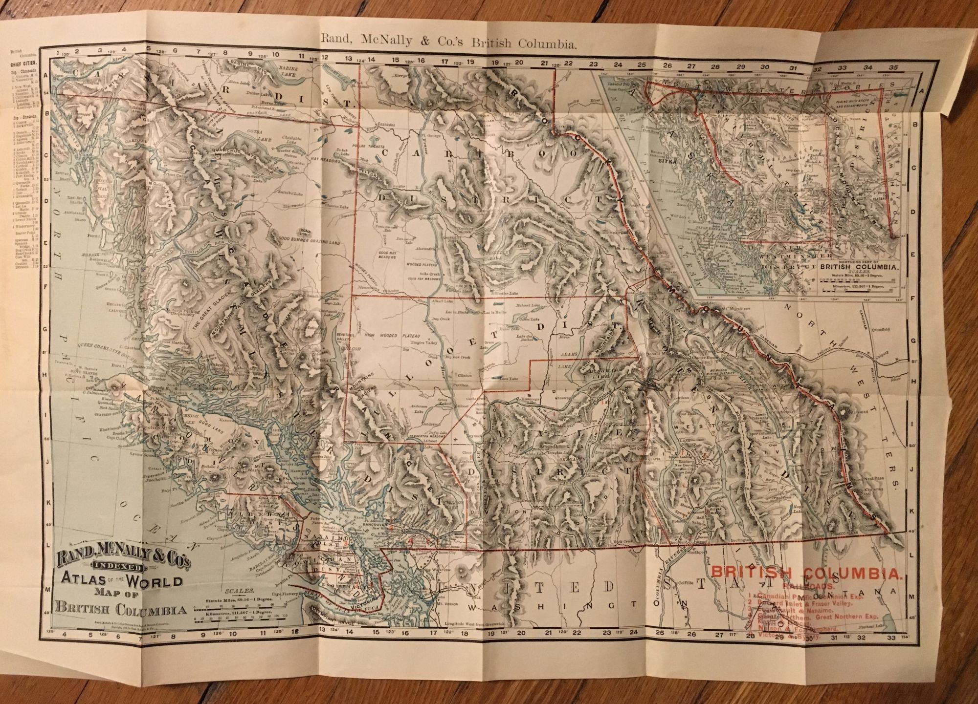
Scarce alternate issue of this first Rand McNally pocket map of British Columbia. The main area of the map depicts the lower two-thirds of the province, with geological features shaded and districts outlined in red. An inset at upper right shows the upper portion of the province that neighbors Alaska. Nine railroads in the Vancouver and Victoria area are delineated in black and numbered in red, with a key printed in red at lower right. The text contains a detailed index and several advertisements for other Rand McNally publications. The wrapper title, Rand McNally & Co.'s Indexed Pocket Map and Shippers' Guide of British Columbia, differs from that of the two copies recorded by OCLC at Cornell and the University of Texas. A third copy at Yale seems to lack wrappers and index. A scarce pocket map in alternate wrappers.
Price: $500.00