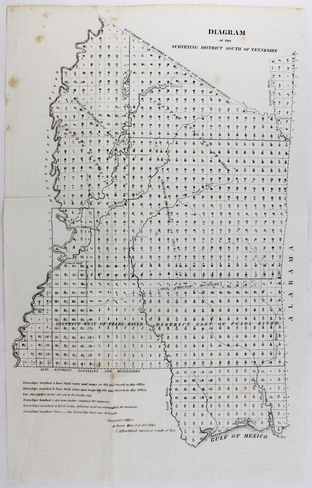
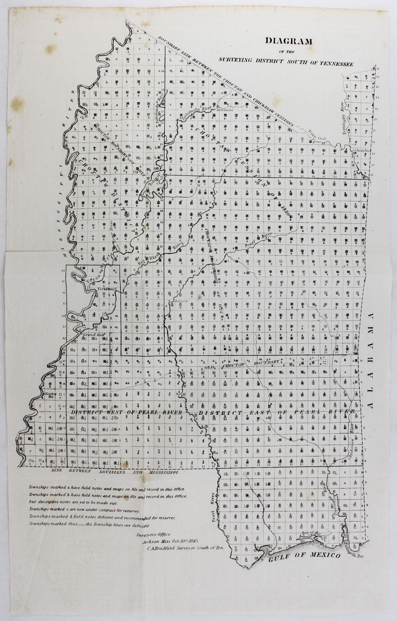
Diagram of the Surveying District South of Tennessee
Jackson, Ms. Surveyor's Office, 1845. Lithographic map, 18.25 x 11.5 inches. Old folds and creases, minor foxing, very short split along one fold line. Very good. Item #3668
A rare survey map depicting Choctaw and Chickasaw cessions after the Indian Removal Act of 1830, and showing the changes wrought by the ensuing fifteen years of land speculation in the area. The map itself centers on land in the Mississippi Territory south of the "Boundary Line Between the Choctaw and Chickasaw Cessions" down to the Gulf of Mexico, bounded in the west by the Mississippi River and in the east by the Alabama state line. The various areas within the body of the map are defined as "Choctaw District," "Choctaw Boundary of 1822," "Choctaw Cession of 1830," "Old Choctaw Boundary," as well as the "District West of Pearl River" and "District East of Pearl River." The map was first issued in 1838, then again in 1841 and 1843 as development and land ownership within the territory changed. Ultimately the map is an intermittent record of the impact of Indian removal in the region, reflecting the western exile of the Choctaw peoples who eventually ended up in Oklahoma. This example appears to be a separately-issued version of the map, without the printed notation in the upper left corner which identifies the Senate version.
Price: $450.00