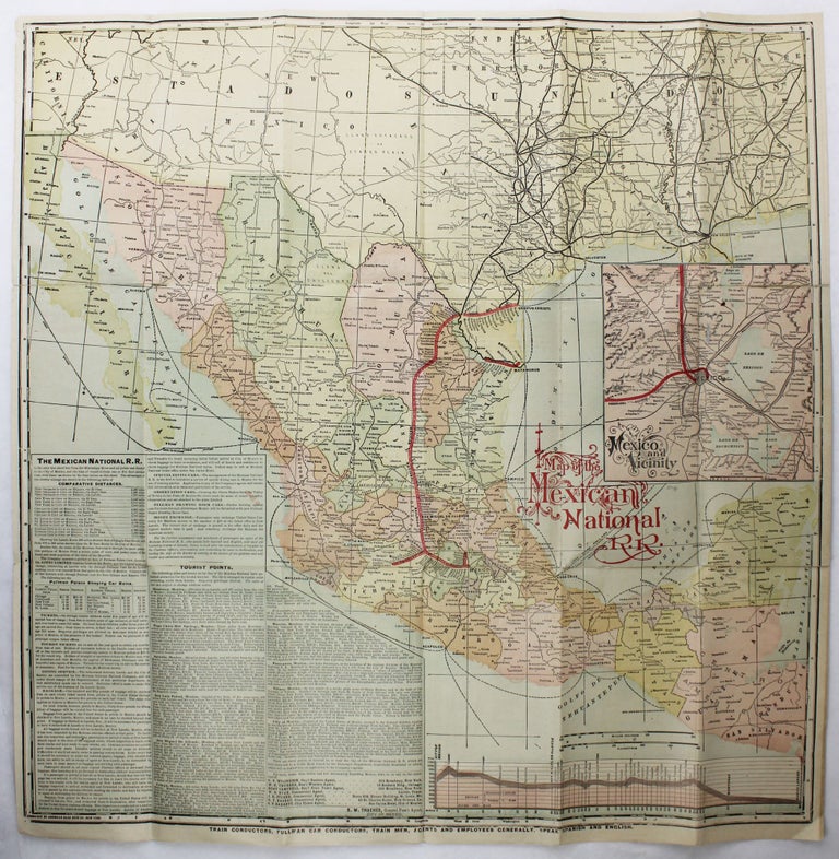
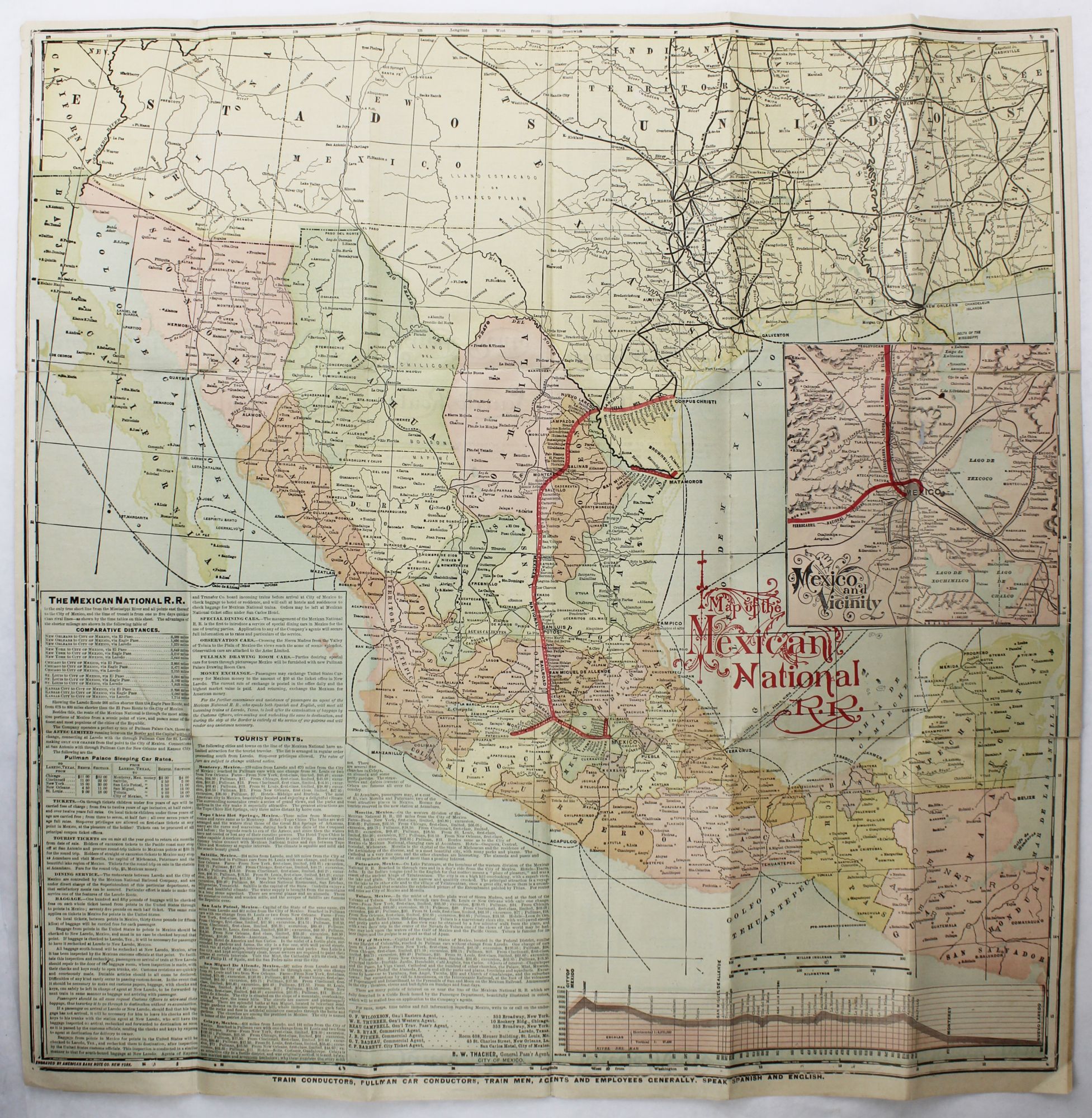
Map of the Mexican National R.R. - Laredo Route. Short Line to Monterey, Saltillo, San Luis Potosi, San Miguel de Allende, Celaya, Morelia, Patzcuaro, Toluca, and the City of Mexico
New York: C.G. Crawford, Printers & Stationer, [ca. 1900]. Large color-printed folding map, 24 x 23.75 inches, with accompanying promotional text in the margins and on verso, folded to pocket size. Minor, expert tissue reinforcements to some folds, a few tiny areas of loss within the map, mild dust-soiling. Very good. Item #3011
A large and informative map of Mexico and the American Southwest, tracing the Laredo Route of the Mexican National Railroad from Mexico City and its surrounds to Corpus Christi, Texas. The right portion of the map includes an inset of the railroad’s route around and through Mexico City. The supplemental text includes timetables, rates, points of interest, dining information, and more. The National Railroad of Mexico was one of the primary pre-nationalization railways of Mexico. Incorporated in Colorado in 1880 as the Mexican National Railway, and helmed by General William Jackson Palmer of the Denver and Rio Grande Railway, it reorganized in 1887 and completed a narrow-gauge main line from Mexico City to Nuevo Laredo in September 1888. The map was engraved by the American Bank Note Company of New York.
Price: $850.00