
Stonewall County
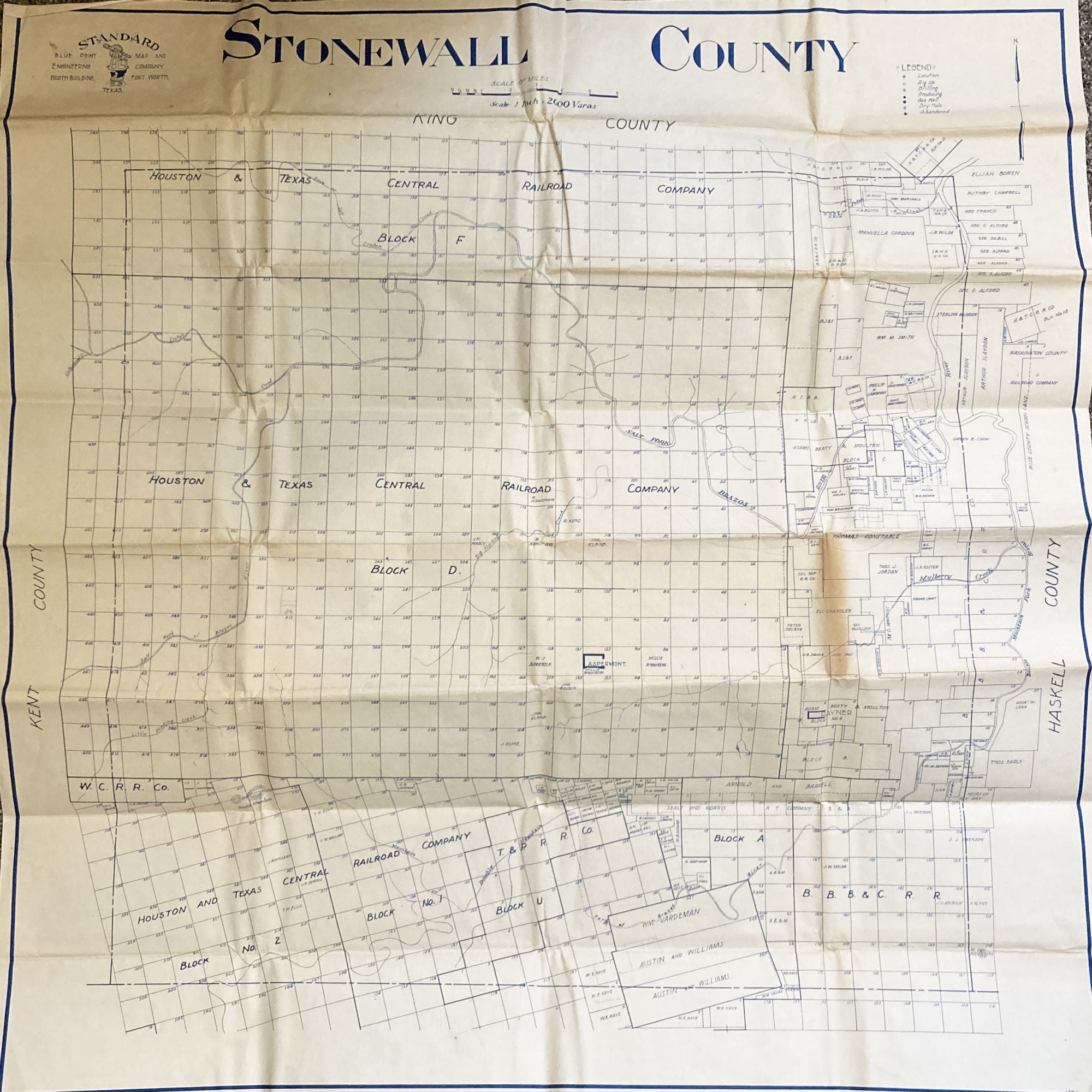
Fort Worth: Standard Blue Print Map and Engineering Company, [ca. 1925]. Large blue line map, approximately 37.5 x 36.5 inches. Several patches of discoloration along folds. Light dust soiling and toning. Very good. Item #3008
An unrecorded, quite detailed map of land ownership, oil wells, and development in Northwest Texas, published circa 1925 by the Standard Blue Print & Map Company of Fort Worth. This attractive chart shows ownership of land and locations of oil development across the sparsely populated Stonewall County, Texas, north of Abilene during the mid-1920s, prior to any major industrial development. Owners for every parcel of land on the map are printed; a few oil and gas wells, producing, being developed, and abandoned, are marked with blue and white circles. The map delineates larger blocks of land controlled by railroad companies, mostly the Houston & Texas Central Railroad, as well as the individual owners of smaller parcels and scattered holdings belonging to a couple of business entities, though interestingly none of the major oil and gas corporations.
Contemporary advertisements for the publisher, Standard Blue Print Map and Engineering, promote the availability of over 200 oil maps of Texas, Oklahoma, New Mexico, Louisiana, and Arkansas from the firm, but only a handful are recorded, all in single copies. We locate no copies of the present map in OCLC.
Price: $1,500.00