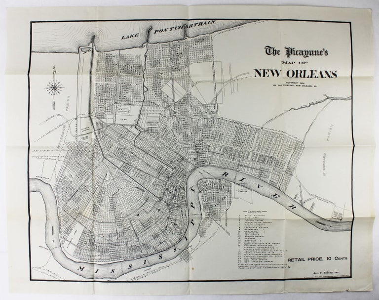
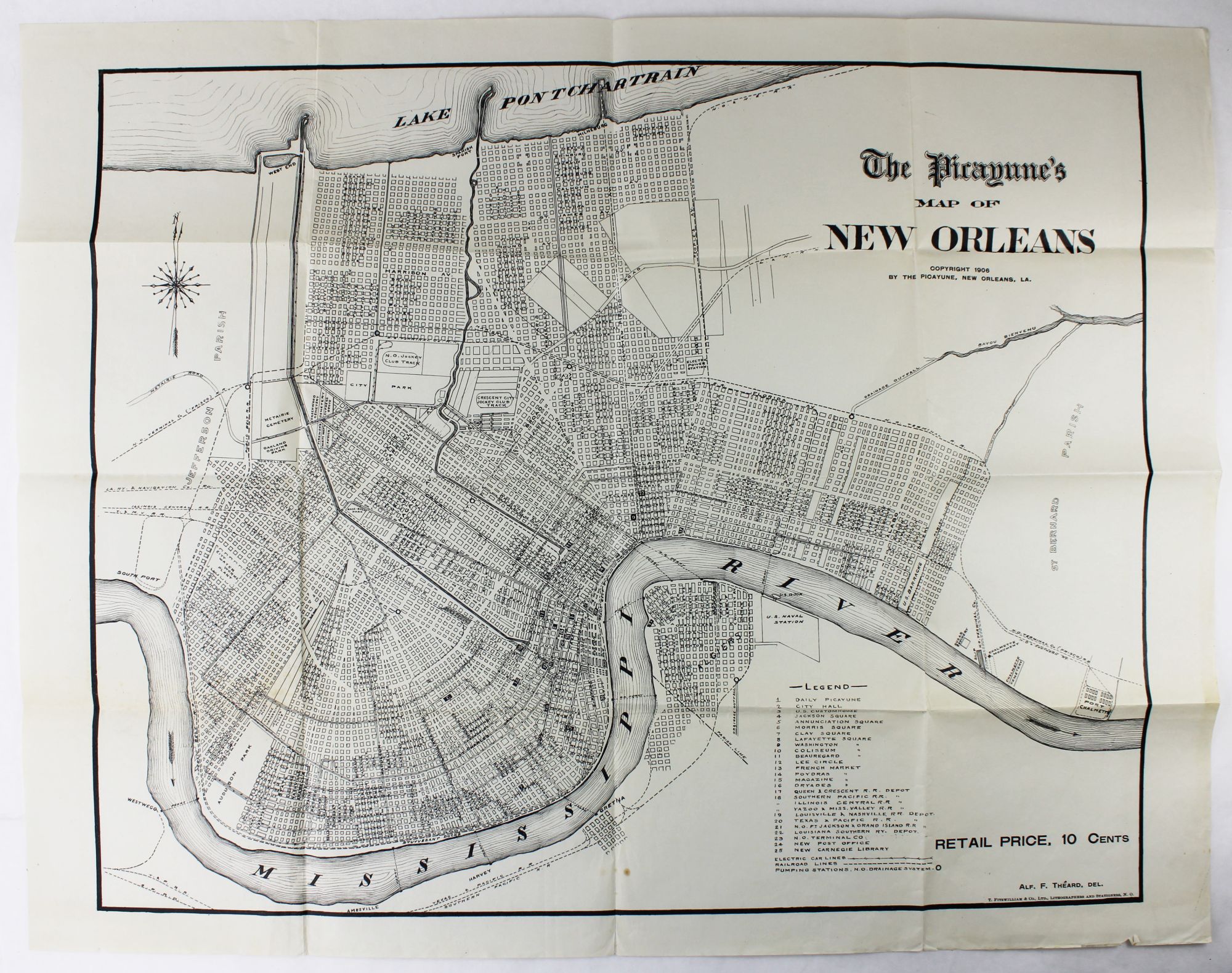
The Picayune's Map of New Orleans
New Orleans: 1906. Sheet map, 22 x 28 inches. Old folds. Minor soiling and wear. Very good. Item #2664
Scarce map of New Orleans issued by the Times Picayune. The map shows the city spread between Lake Pontchartrain to the north and the Mississippi River to the south, with details of streets, drainage, railroads, electric car lines, and other points of interest. A numbered legend highlights various important locales such as the Picayune's offices, City Hall, different squares and parks, the French Market, and the railroad hubs.
Price: $450.00
See all items by Louisiana