![Item #2206 Special Map of Latimer County, Okla. [with additional plat map]. Oklahoma.](https://mcbriderarebooks.cdn.bibliopolis.com/pictures/McBRB2206.jpg?width=768&height=1000&fit=bounds&auto=webp&v=1628954686)
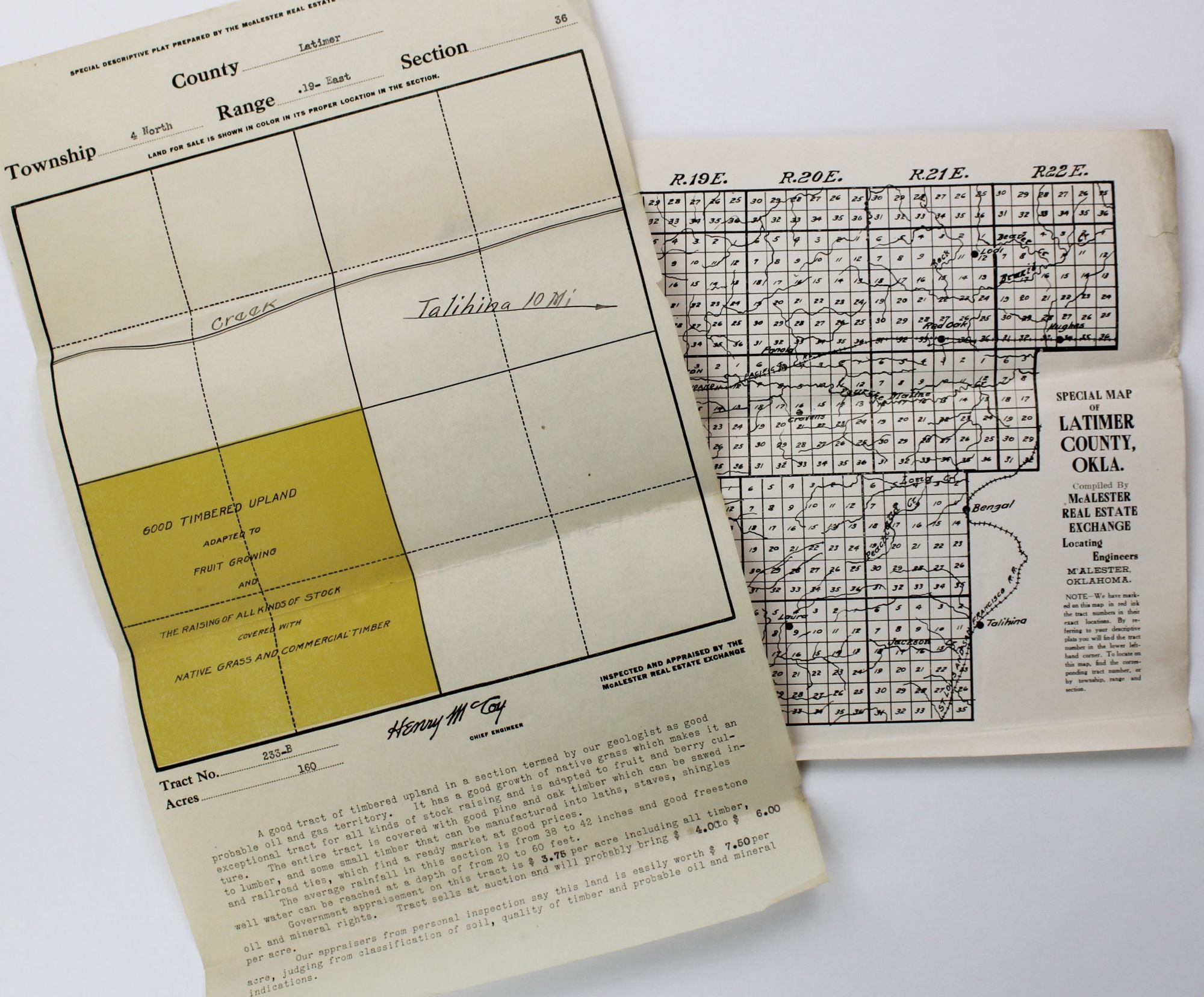
Special Map of Latimer County, Okla. [with additional plat map]
McAlester, Ok. McAlester Real Estate Exchange, [ca. 1910s]. Two maps, 8.5 x 11 & 14 x 8.5 inches. Folded. Light wear and a couple of small chips at edges. Occasional dust soiling. A few contemporary manuscript and typed annotations. Very good. Item #2206
A pair of ephemeral promotional maps from the McAlester Real Estate Exchange, offering a plot of 160 acres for sale in southern Latimer County, Oklahoma. One map delineates the plat of the entire county, with town, rivers, and railroads added, and is annotated to point out the location of the property. The second map contains a close-up of the specific township section, with the land in question shaded in yellow. At the foot of the map is a promotional text completed in type with supposedly recent appraisal values and sale prices. The advertisement promises, "Timbered upland in a section termed by our geologist as good probable oil and gas territory," with "a good growth of native grass" and "good pine and oak timber which can be sawn into lumber."
These claims, however, were almost entirely fraudulent. The McAlester Real Estate Exchange was established by Roy Van Tress soon after Oklahoma gained statehood, who promised to obtain for his customers the rights to Indian Lands being sold by the federal government sight-unseen and without requirements of occupation or homesteading. From headquarters in Cincinnati and McAlester, as well as from mobile railcar offices, salesmen of the firm offered land that they often had no right to sell or was devoid of the bounty of natural resources and rich soil promised in the present advertisements. Van Tress himself was dogged by investigation into his business, and was eventually convicted of fraud in 1919 but managed to escape jail time. We locate no other copies of promotional maps for this long-running and noted Oklahoma land fraud.
Price: $850.00