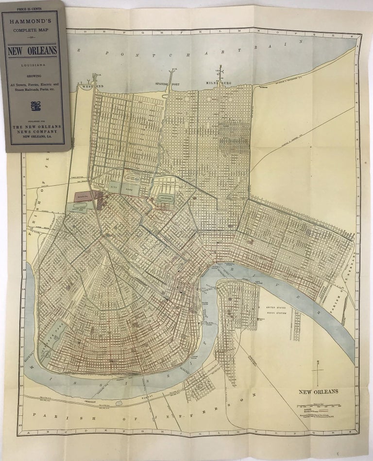
Hammond's Complete Map of New Orleans, Louisiana Showing All Streets, Ferries, Electric and Steam Railroads, Parks, Etc.
[New York: 1908]. Folding map, 23 x 19 inches folded to 7.5 x 3.5 inches. Original grey printed card covers. Minor wear to covers, a few small spots of foxing and wear to map. Very good plus. Item #1418
Handsome map of New Orleans printed in color, with the canals, railroads, and electric street car lines highlighted. The map depicts the city from Lake Pontchartrain to the Mississippi, showing minimal settlement south of the river, primarily in the neighborhood of Algiers. Audubon Park, Metairie Cemetery, the city park, and fair grounds are all highlighted, as are many other smaller squares, cemeteries, and green spaces, including the Oakland Driving Park (today the New Orleans Country Club's golf course). At the time, New Orleans was a city of about 300,000 people. The present map shows that most of the neighborhoods along the Mississippi were traversed by "electric railways," with one line traveling north to the lake and terminating at West End, while one line operated on the south side of the river. There are also numerous railroads delineated, and several ferries crossing the river. A detailed look at the streets of New Orleans at the turn of the century. We locate fewer than ten copies in OCLC.
Price: $450.00