![Item #1277 Copy of Official Primary Road System of Iowa [cover title]. Iowa.](https://mcbriderarebooks.cdn.bibliopolis.com/pictures/McBRB1277_01.jpg?width=768&height=1000&fit=bounds&auto=webp&v=1587503407)
![Copy of Official Primary Road System of Iowa [cover title]](https://mcbriderarebooks.cdn.bibliopolis.com/pictures/McBRB1277_02.jpg?auto=webp&v=1587503407)
![Copy of Official Primary Road System of Iowa [cover title]](https://mcbriderarebooks.cdn.bibliopolis.com/pictures/McBRB1277_03.jpg?auto=webp&v=1587503407)
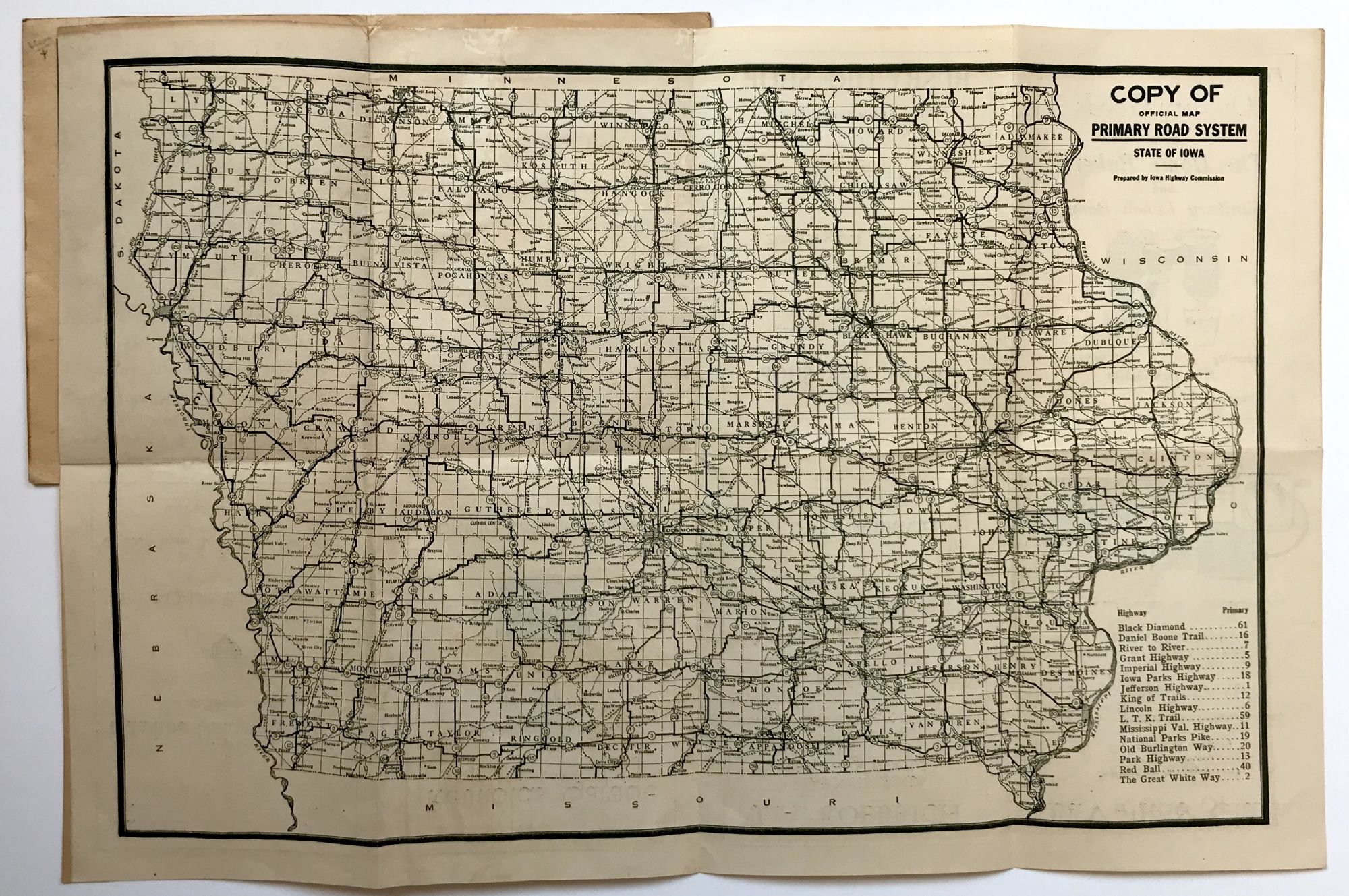
Copy of Official Primary Road System of Iowa [cover title]
Waterloo, Ia. [ca. 1925?]. Folding map, 11.5 x 17.5 inches, in a printed card cover, 6.25 x 4.75 inches. Light wear and soiling to covers. Map with slight separation at corner folds, lightly toned. Very good. Item #1277
A map of the roads in Iowa, prepared by the state Highway Commission. The map is pasted into printed card covers advertising the Harrison Motor Co. of Nashua, Iowa; the cover also includes a list of automobile license prefix numbers for the state. The verso of the map is printed with ads for several related establishments in Charles City (a garage, tires, etc). The map, which shows the state gridded out by counties and crisscrossed with roads, lists sixteen specific highways by name in the lower corner, including the Daniel Boone Trail, the Iowa Parks Highway, King of Trails, National Parks Pike, and the Great White Way. Though there are several state highway maps from the 1920s and 1930s, we find nothing that matches the description of this "Copy of" the official road map in OCLC. A nice local item.
Price: $450.00