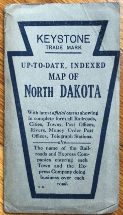
Map of North Dakota with Population and Location of Principal Towns and Cities
Des Moines: Kenyon Company, 1920. Folding map, 15.25 x 19.5 inches. Light wear and dust soiling to wraps. Very light, even tanning to map. Scarce, colorful folding map of North Dakota. The state counties are shaded in six different colors, with congressional districts outlined in red, and "Chief Auto Lines"..... More
![Item #2654 [Vernacular Snapshot Album of an Automobile Trip Through the American Southwest]....](https://mcbriderarebooks.cdn.bibliopolis.com/pictures/McBRB2654_01.jpg?width=320&height=427&fit=bounds&auto=webp&v=1646857899)
![Item #724 Cheyenne Wyoming to Omaha Nebraska via Lincoln Highway 538.5 Miles [cover title]....](https://mcbriderarebooks.cdn.bibliopolis.com/pictures/McBRB724.jpg?width=320&height=427&fit=bounds&auto=webp&v=1562074698)