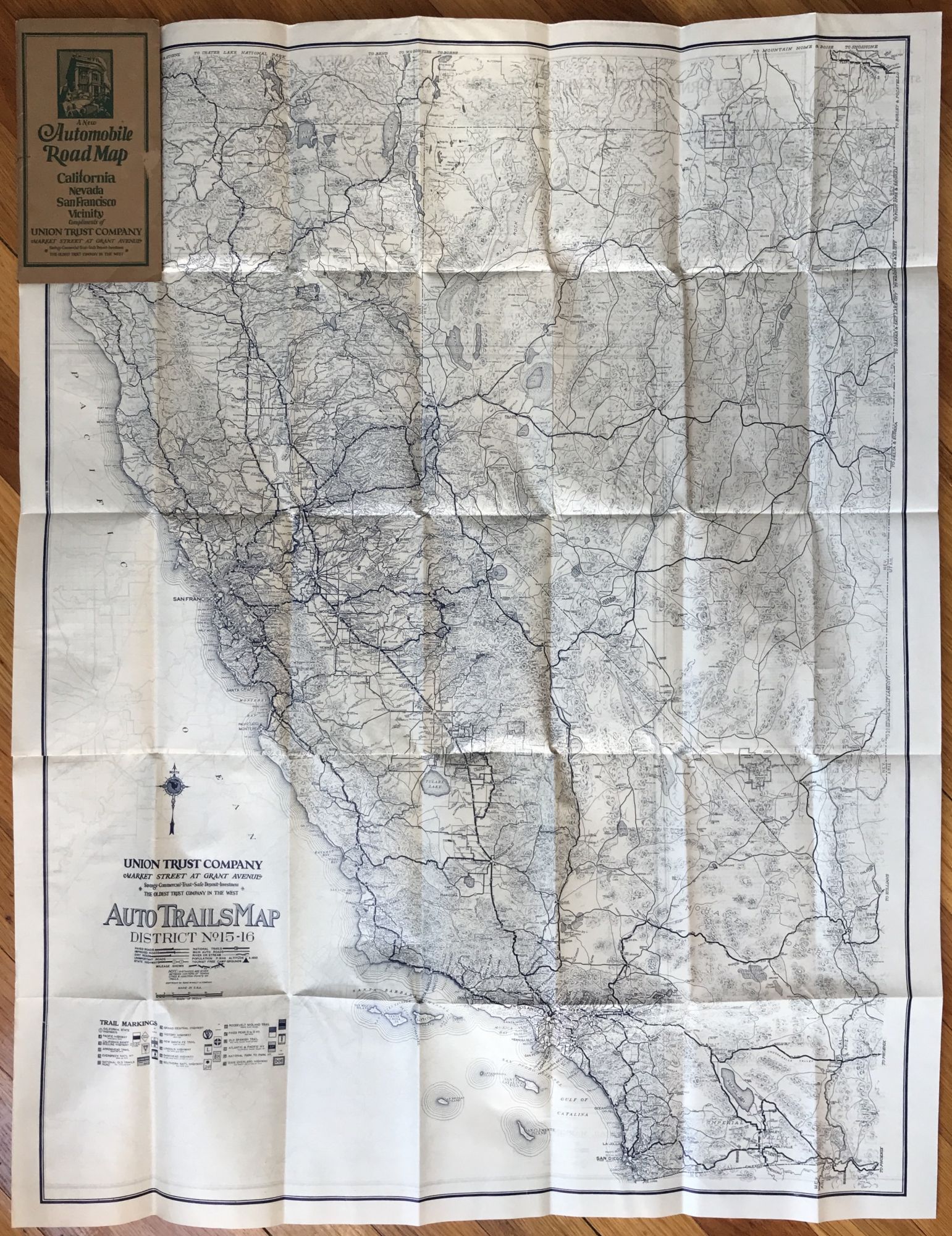
Auto Trails Map No. 15-16 / Auto Trails Map of San Francisco and Vicinity
San Francisco: Union Trust Company, [1922]. Folding map, 34 x 26 inches. Original printed wrappers. Closed from head of front wrap near gutter; a couple of scuff marks on front and rear. Map fine. About very good. Item #952
An interesting and scarce promotional for a San Francisco financial firm, comprising two road maps, one of California and Nevada and the other of the Bay Area. The two-sided map was issued in 1922 by Rand McNally, but here has had advertising for the Union Trust Company added to its legend and had been tipped into wrappers promoting the firm. In addition to providing a detailed outline of roads in the two western states and around the San Francisco Bay, the verso of the map also prints a text describing the banking services of Union Trust, a synopsis of the 1921 California Motor Vehicle Act, and Bay ferry time tables, as well as a list of incorporated towns found on the map and their populations. The Union Trust Building still stands at the intersection of Market, Grant, and O'Farrell in downtown San Francisco, as advertised by the present map, although the company was bought out by Wells Fargo the year after this promotional was published. We locate two copies of the regular issue of this map, in the Rand McNally collection at the Newberry and at Northern Arizona University, and no copies of this production.
Price: $400.00