![Item #724 Cheyenne Wyoming to Omaha Nebraska via Lincoln Highway 538.5 Miles [cover title]. Wyoming, Nebraska, Automobiles.](https://mcbriderarebooks.cdn.bibliopolis.com/pictures/McBRB724.jpg?width=768&height=1000&fit=bounds&auto=webp&v=1562074698)
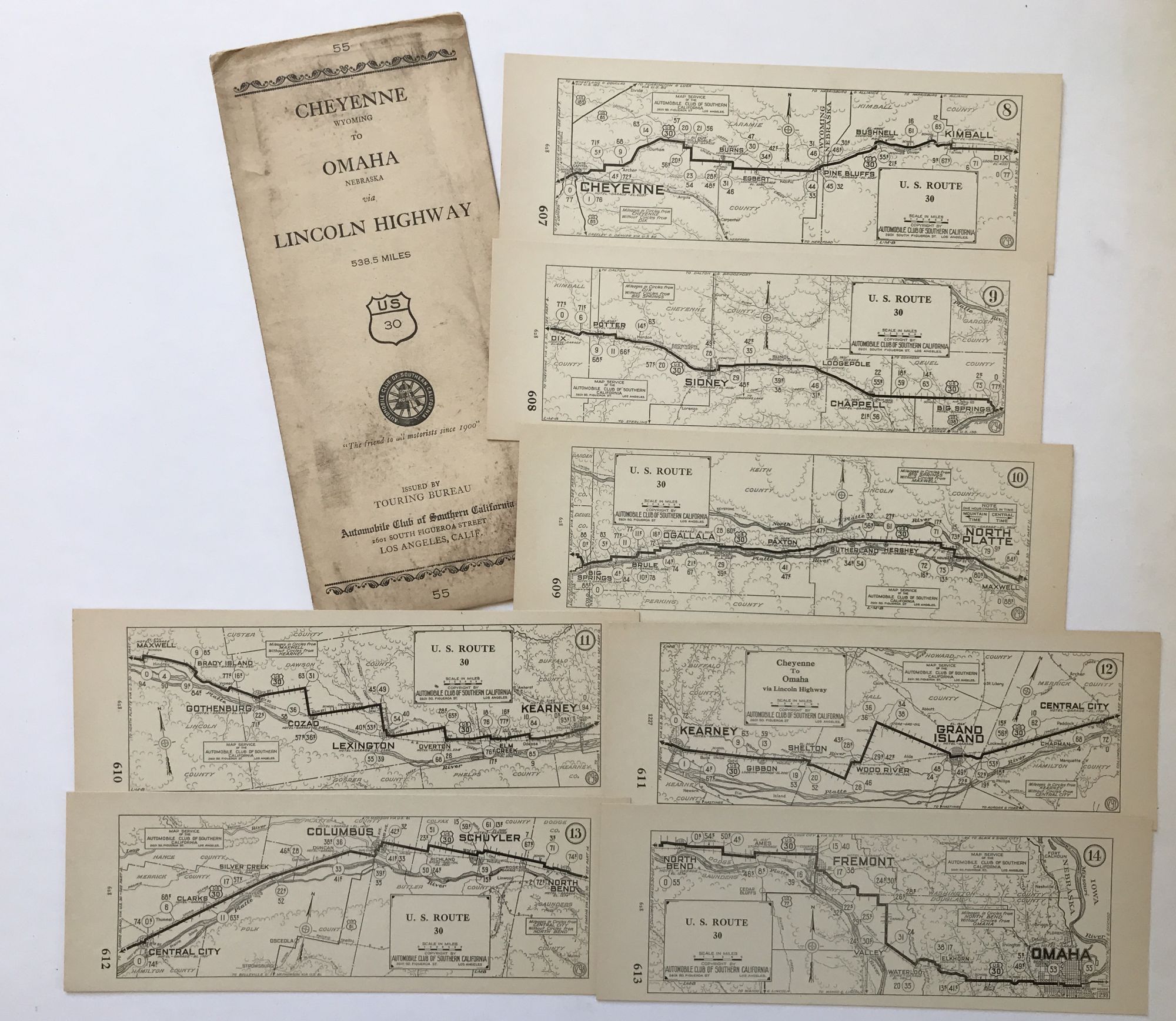
Cheyenne Wyoming to Omaha Nebraska via Lincoln Highway 538.5 Miles [cover title].
Los Angeles: Automobile Club of Southern California, [ca. 1918]. Map on seven individual cards, each 3.75 x 10 inches, in original printed storage envelope. Envelope with some dust soiling and light wear. Light tanning to map cards. Overall, very good. Item #724
Rare map of a western section of the Lincoln Highway from Cheyenne to Omaha, published at the end of the 1910s by the Automobile Club of California. The highway, as conceived and dedicated in 1913, ran from Times Square in New York City to Lincoln Park in San Francisco on state and federal roads; today the route is largely superseded by Interstate 80. This part of the route, consisting of just under 600 miles of roads, ran on U.S. Highways 30, from Cheyenne passing through Kimball, Big Springs, Ogallala, North Platte, Kearney, Grand Island, Columbus, and Fremont before reaching Omaha. The Automobile Club of Southern California published several such sectional route maps of the Lincoln Highway during the late 1910s, but the present map is not located in any institutions by OCLC.
Price: $500.00