![Item #487 State Water Project, Oroville Division. Major Construction Features and Recreation Areas [caption title]. California, Water.](https://mcbriderarebooks.cdn.bibliopolis.com/pictures/McBRB487_01.jpg?width=768&height=1000&fit=bounds&auto=webp&v=1555719767)
![State Water Project, Oroville Division. Major Construction Features and Recreation Areas [caption title]](https://mcbriderarebooks.cdn.bibliopolis.com/pictures/McBRB487_02.jpg?auto=webp&v=1555719767)
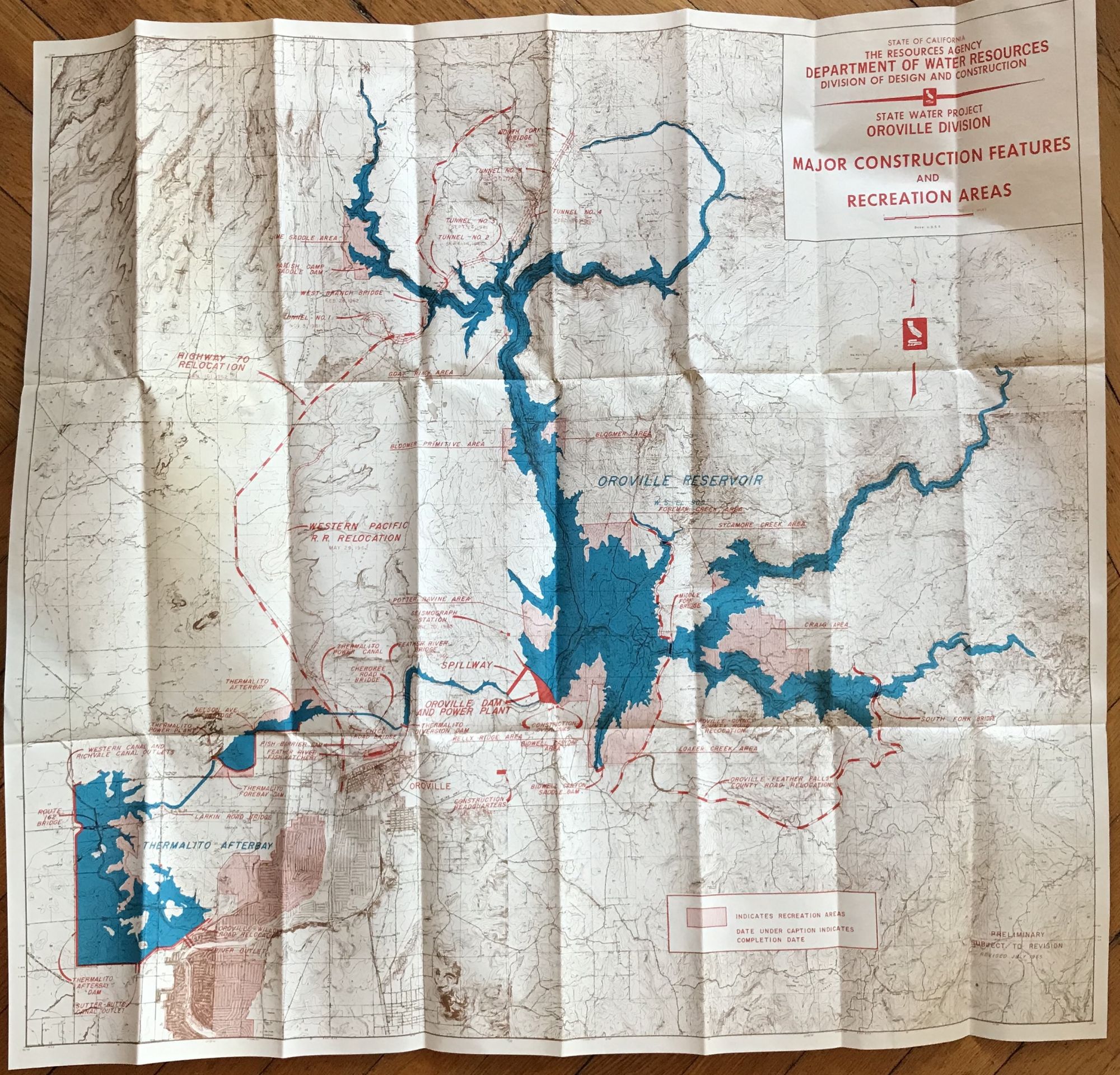
State Water Project, Oroville Division. Major Construction Features and Recreation Areas [caption title]
[Sacramento. 1965]. Large folding map, 28 x 32 inches. Very minor wear at a few folds. With original mailing envelope, somewhat worn and foxed. Very good. Item #487
A surprisingly scarce map of the construction of Oroville dam and surrounding area in California. The dam is of recent fame for nearly failing in February 2017 when the spillways were on the verge of collapse, leading to the evacuation of 188,000 people. At the time of its construction in the 1960s, it was one of the largest and most controversial water projects undertaken in the state. The map depicts the overall construction plan for the area, including the dam itself, anticipated reservoir areas, tunnels and bridges, highway relocations, and many other features. The topographical detail of the map is extremely fine.
There were issues of the map from 1964 (one copy listed in OCLC), 1966 (three copies located), and this 1965 issue, with "Revised July 1965" printed in the lower right corner, with just one copy located, at the University of California Riverside. This copy is accompanied by the original mailing envelope, not addressed or stamped, indicating that the map was sold as a souvenir by the "Vista House," a view point overlooking the construction site.
Price: $675.00