![Item #2636 Map of Dakota, Drawn from Official Plats of Public Surveys, and Published in the Interests of Immigration [caption title]. Dakota, Maps.](https://mcbriderarebooks.cdn.bibliopolis.com/pictures/2636.jpg?width=768&height=1000&fit=bounds&auto=webp&v=1644179696)
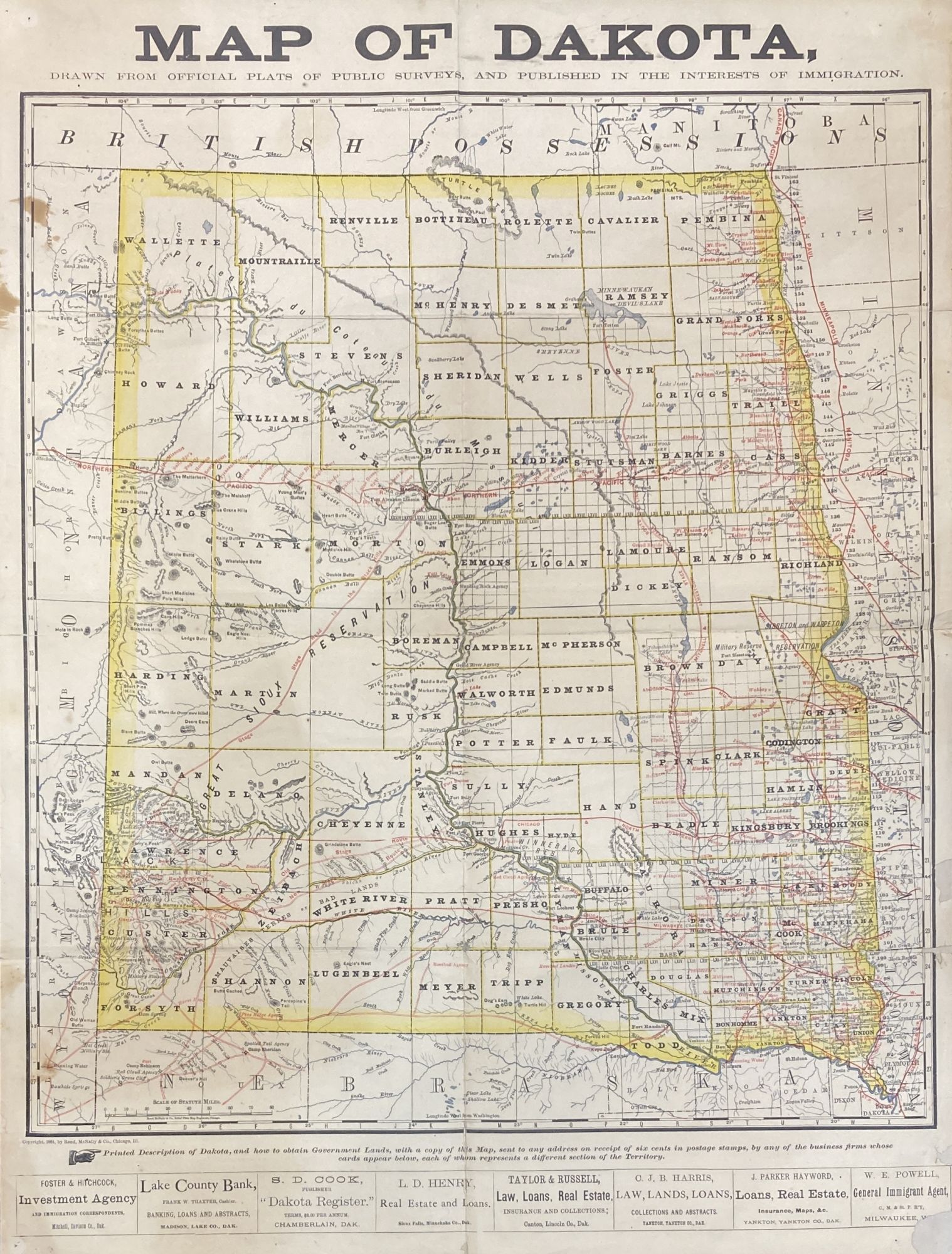
Map of Dakota, Drawn from Official Plats of Public Surveys, and Published in the Interests of Immigration [caption title]
Chicago: Rand McNally, 1881. Sheet map, 25 x 19 inches. Previously folded. Printed in four colors. Short separations along old folds and minor losses at fold points and lower right edge, sympathetically repaired but slightly affecting printed area. Light tanning and occasional, small patches of dampstaining. About very good. Item #2636
A rare, early Rand McNally map of the Dakota Territory, published in 1881 just before division and statehood. As utilized here, it comprises a promotional for land agents in the southeastern corner of what would become South Dakota -- Yankton, Sioux Falls, Chamberlain, Mitchell, and Madison -- as well as for an agent in Milwaukee representing the Chicago, Milwaukee, and St. Paul Railway. Their business names and locations are printed along the lower edge of the sheet. The map itself, which occupies nearly the entire sheets, depicts one, big Dakota, with territorial and individual county boundaries outlined in yellow, railroad lines and stage routes delineated in red, and rivers are drawn in a light grey-blue. According to additional text at the foot, the map and separate descriptive pamphlet were available from the listed agents for six cents postage.
An attractive map, and one of the last before North Dakota and South Dakota came into being, "Published in the Interests of Immigration." Not recorded in OCLC in this form, and still quite scarce in other formats published by Rand McNally.
Price: $1,375.00