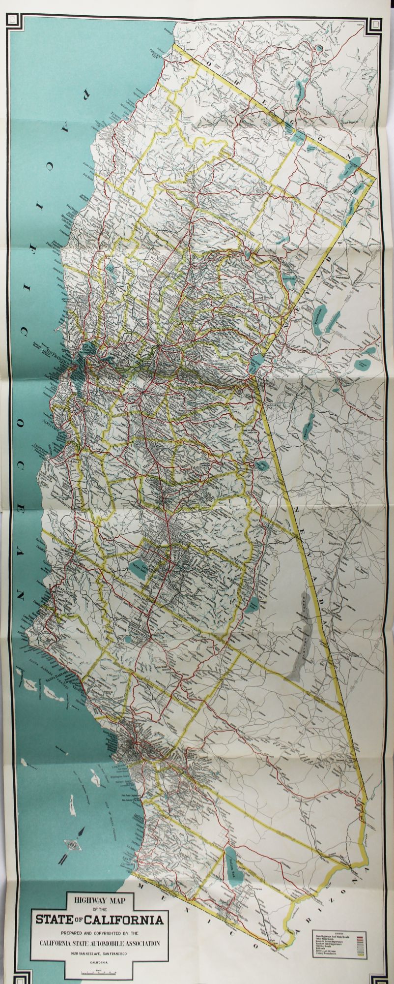
Highway Map of the State of California Prepared and Copyrighted by the California Automobile Association
San Francisco: 1921. Folding map, 41.75 x 16 inches. Folded into card covers, 8.5 x 5.5 inches. Minor wear to map, light rubbing and wear to covers. Very good. Item #2316
A large folding map of the state of California showing primary highways, secondary and tertiary roads, rivers, borders, and railroads. Useful for navigating the burgeoning California highway system. We locate copies at the California State Library, the Sutro, Berkeley, the University of Michigan, and Stanford.
Price: $350.00
See all items by California State Automobile Association