![Item #2289 [Manuscript Survey of 1,280 Acres of Land on the Red River Belonging to Caspar Loewenstein]. Texas, John D. Montague Black, Daniel.](https://mcbriderarebooks.cdn.bibliopolis.com/pictures/McBRB2289.jpg?width=768&height=1000&fit=bounds&auto=webp&v=1640022572)
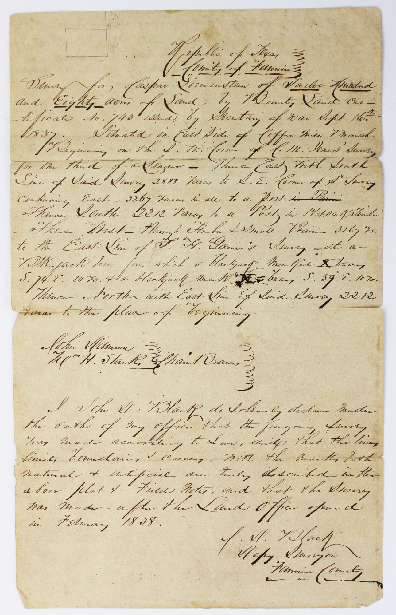
[Manuscript Survey of 1,280 Acres of Land on the Red River Belonging to Caspar Loewenstein]
Fanning County, Tx. [ca. 1840]. [1]p. with manuscript endorsement and docketing on verso. Folio. Old folds, short separations along folds, old tape repair on verso along one horizontal fold line, minor toning. Good plus. Item #2289
A rare Republic of Texas land survey performed by John D. Black and certified on the verso by surveyor Daniel Montague in 1841. The survey text includes a small plat drawing in the upper right corner. The 1,280 acres of North Texas land at hand here was granted to Caspar Loewenstein as a new emigrant to the state, identified as Bounty Land Certificate No. 743 in September 1837. Loewenstein would serve in the Texas 1st Infantry in 1839.
The Republic of Texas issued "'second class' headrights of 1,280 acres to heads of families and 649 acres to single men who immigrated to Texas after the Texas Declaration of Independence but before October 1, 1837 and who also remained in the Republic for three years and performed the duties of citizenship" - Handbook of Texas online.
J.D. Black served as the Fannin County deputy surveyor. Daniel Montague (1789-1876) "traveled down the Mississippi and settled in Louisiana, where he worked as a surveyor and established a plantation. He moved to Texas in 1836 to assist Sam Houston but arrived after the battle of San Jacinto. He then returned to Louisiana to settle his business affairs and in 1837 brought his family to Texas to settle at Old Warren in the Fannin Land District on the Red River. He and William Henderson built a general merchandise store at Warren, probably in 1838. As the first surveyor of that district he amassed a large estate" - Handbook of Texas online.
Price: $2,250.00