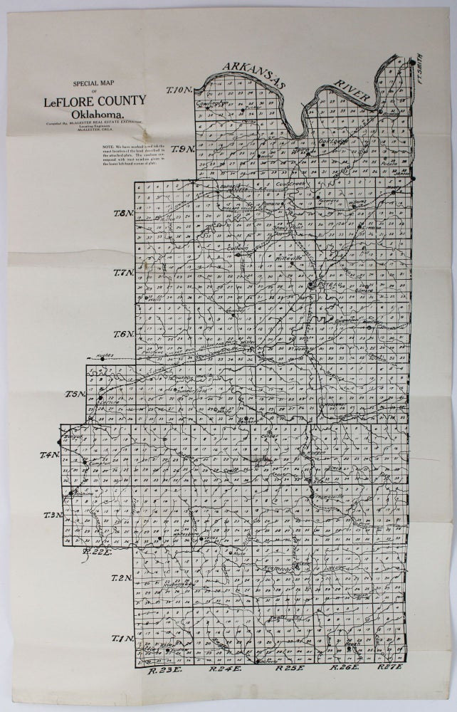
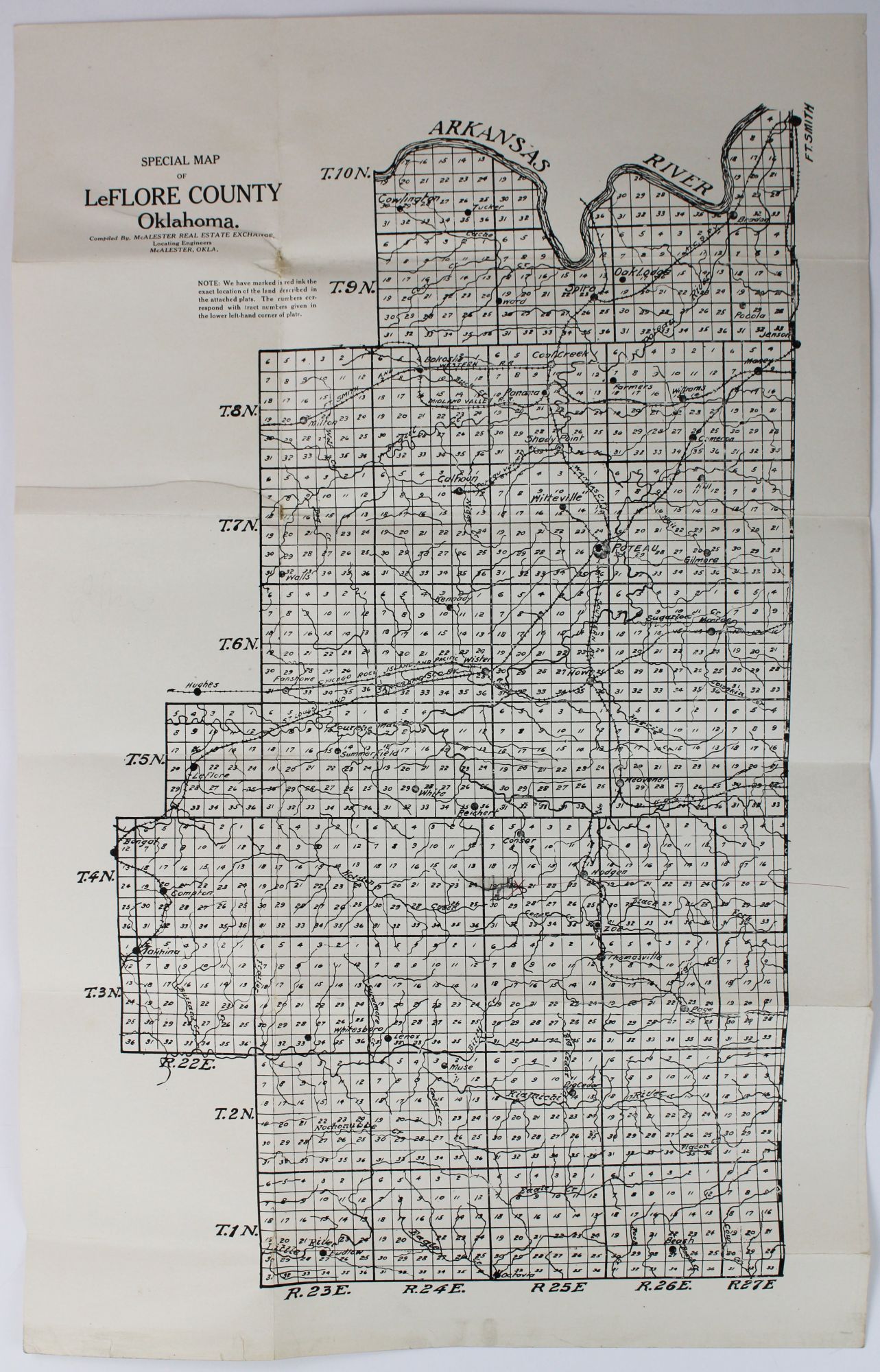
Special Map of LeFlore County, Oklahoma
McAlester, Ok. McAlester Real Estate Exchange, [ca. 1920s]. Printed map, 19 x 12 inches. Original folds, minor dust soiling and edge wear, two tiny expert repairs to strengthen folds on verso. Very good. Item #2208
A seemingly unrecorded real estate promotional cadastral map of LeFlore County, Oklahoma produced by the McAlester Real Estate Exchange. LeFlore County is located in the east-central portion of Oklahoma on the border with Arkansas. The county is bounded in the north by the Arkansas River (with the map also showing numerous other rivers) and its principal cities, such as LeFlore, Talahina, Wittevile, Wister, Whitesboro, Lenox, the county seat of Poteau, and numerous others are included on the present map. Fort Smith is indicated at the extreme top right of the map. The map is divided into quadrants with plots individually numbered within each plot; a previous user of the map has made one pencil and one red notation near the center of the map, just to the west of the town of Hodgen. There are also numerous railroads snaking through the county, such as the Kansas City & Southern, Chicago, Rock Island, and Pacific, the St. Louis and San Francisco, and the Ft. Smith and Midland Valley railways. No copies in OCLC.
Price: $850.00