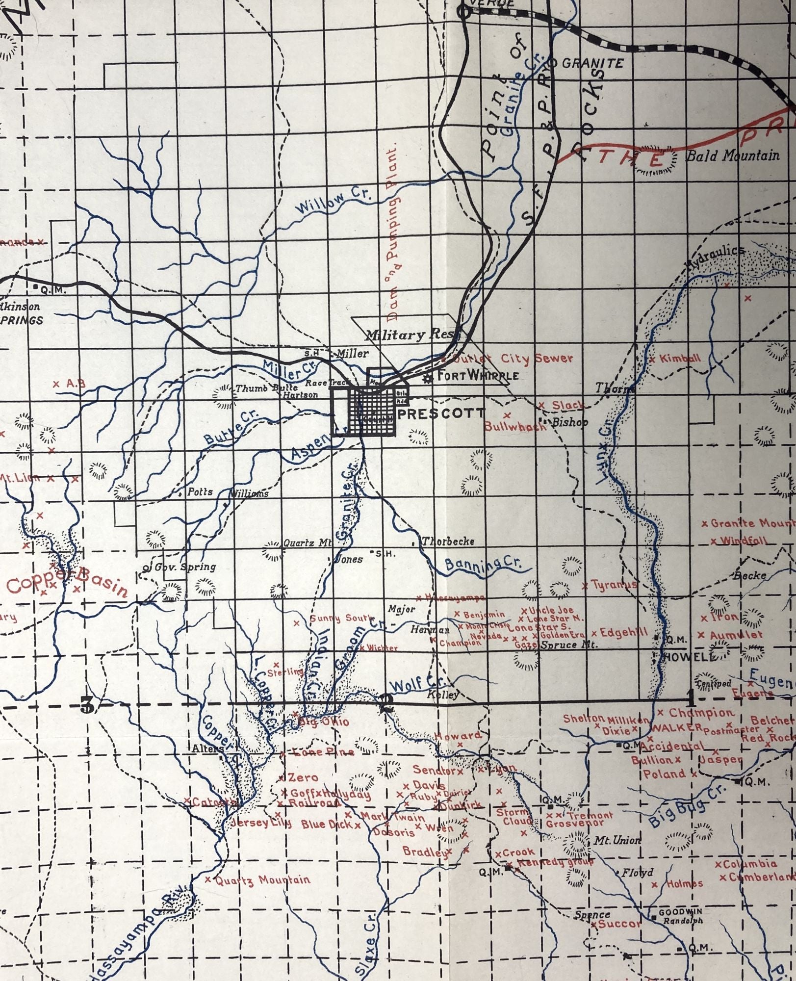
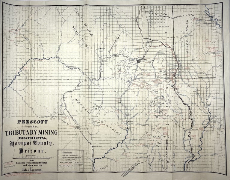
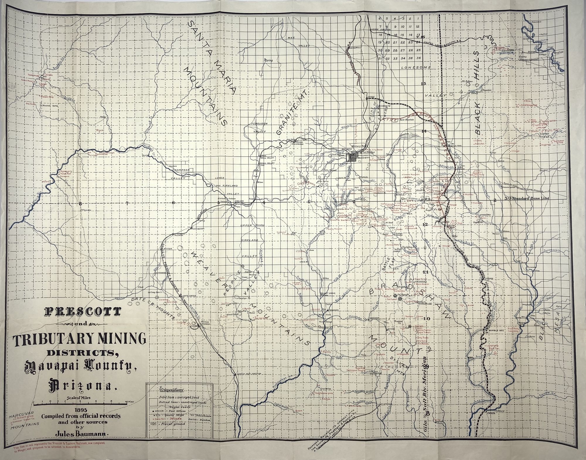
Prescott and Tributary Mining Districts, Yavapai County, Arizona
[Phoenix? 1895]. Large map, 26.75 x 35.5 inches, partially color printed. Previously folded, removed from wrappers with stub at lower left edge. Minor separations along folds from edges; one larger separation repaired unobtrusively with tape on verso. About very good. Item #1774
Scarce and detailed map delineating mine locations near Prescott, Arizona, published by Jules Baumann, a Swiss immigrant and local resident. Baumann was born in Switzerland in 1855 and arrived in Prescott in 1879, where he wore many hats, including those of town band leader and ice cream shop owner. Perhaps more significantly, he published rare bird's-eye views of Prescott and the Grand Canyon during the 1890s and operated mining ventures in the area well into the 20th century. The present map shows hundreds of named mines, ranches, school houses, towns, railroads, roads, and post offices. The mines, each named and located by a small "x," are printed in red, while the numerous rivers and streams are overprinted in blue. The Prescott & Eastern Railroad, a short line that connected the town of Prescott to the mines in the Black Canyon south and east is also delineated in red. We locate six copies, at Stanford, UT Arlington, and four Arizona institutions.
Price: $750.00