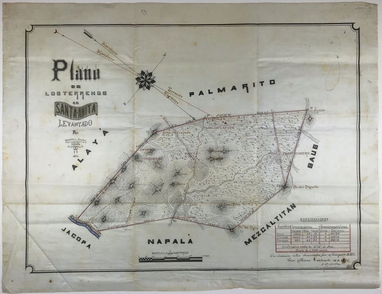
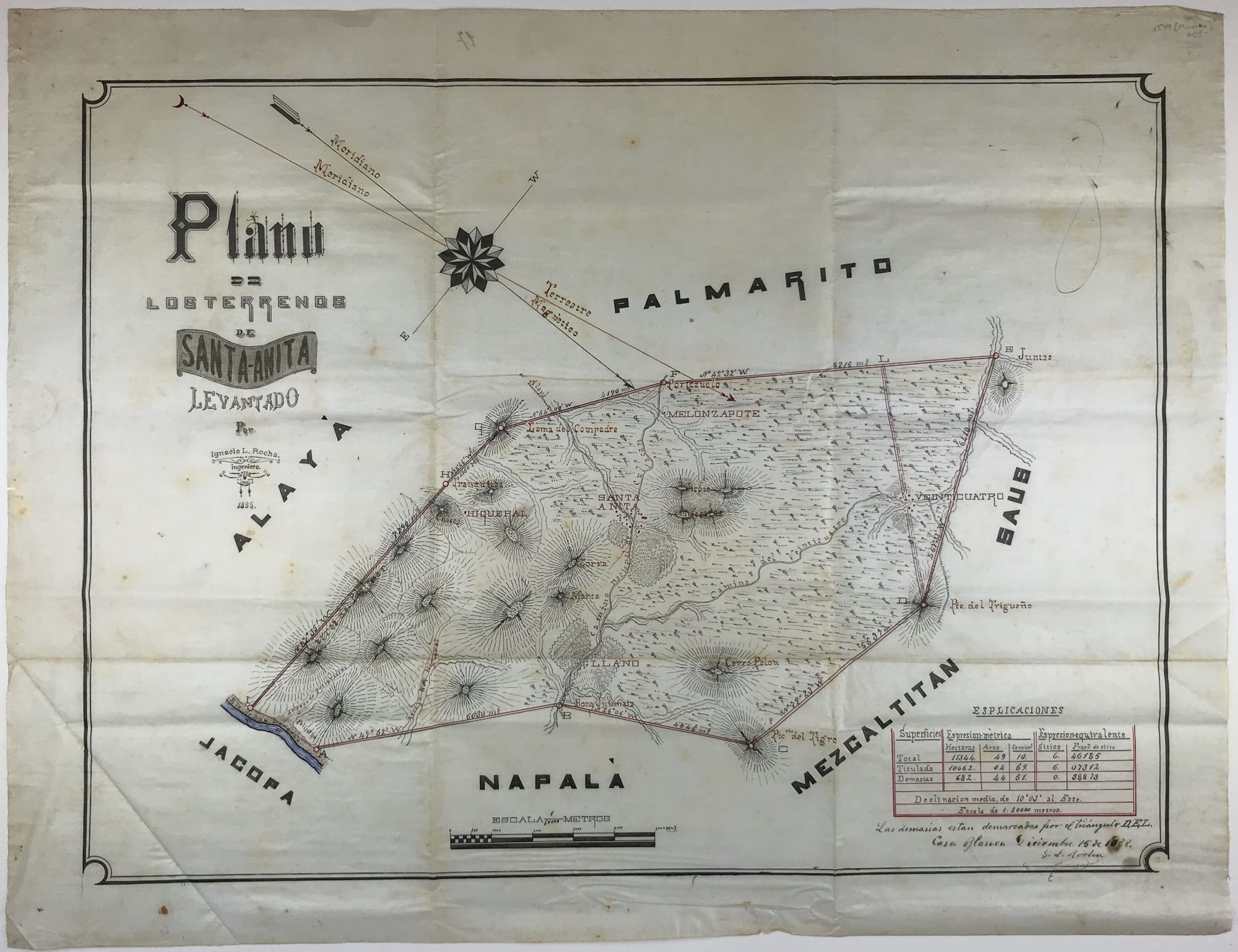
Plano de los Terrenos de Santa-Anita Levantado por Ignacio L. Rocha, Ingeniero
Casa Blanca: 1888. Manuscript map, 18 x 23.5 inches. Drawn in black, red, and blue. Previously folded. Minor soiling and wear. Very good. Item #1549
An attractive manuscript map depicting the topography surrounding the small Sinaloan town of Santa Anita, southeast of Culiacán, near El Comedero. The map is somewhat oddly oriented, with due north pointing toward the lower right corner of the sheet. It shows Santa Anita at its center, with mountains to its east and dry plains to the west, heading toward the Pacific Ocean. Two trails, labeled "Camino Nacional de Culiacan" and "Camino del Veinticuatro" connect Santa Anita to the even smaller towns of Llano and Veinticuatro at the map borders. A small section of the Rio San Lorenzo is detailed at the eastern edge of the map area for context. The map was surveyed and drawn by Ignacio L. Rocha, a graduate in 1883 of the reformed Colegio Rosales, first founded in 1874. Three other maps by Rocha are located in the Mexican Agricultural Archives. A neat and appealing example.
Price: $750.00