![Item #1022 [Typescript Report on Castle Rock Coal Mine, with Maps and Photographs]. Washington, Mining.](https://mcbriderarebooks.cdn.bibliopolis.com/pictures/McBRB1022_02.jpg?width=768&height=1000&fit=bounds&auto=webp&v=1576676020)
![[Typescript Report on Castle Rock Coal Mine, with Maps and Photographs]](https://mcbriderarebooks.cdn.bibliopolis.com/pictures/McBRB1022_03.jpg?auto=webp&v=1576676020)
![[Typescript Report on Castle Rock Coal Mine, with Maps and Photographs]](https://mcbriderarebooks.cdn.bibliopolis.com/pictures/McBRB1022_04.jpg?auto=webp&v=1576676020)
[Typescript Report on Castle Rock Coal Mine, with Maps and Photographs]
Seattle: Dam Brothers, 1917. [18]pp. plus two leaves of photographs and four maps (two folding). Folio. Original red leather wrappers. Minor wear. Near fine. Item #1022
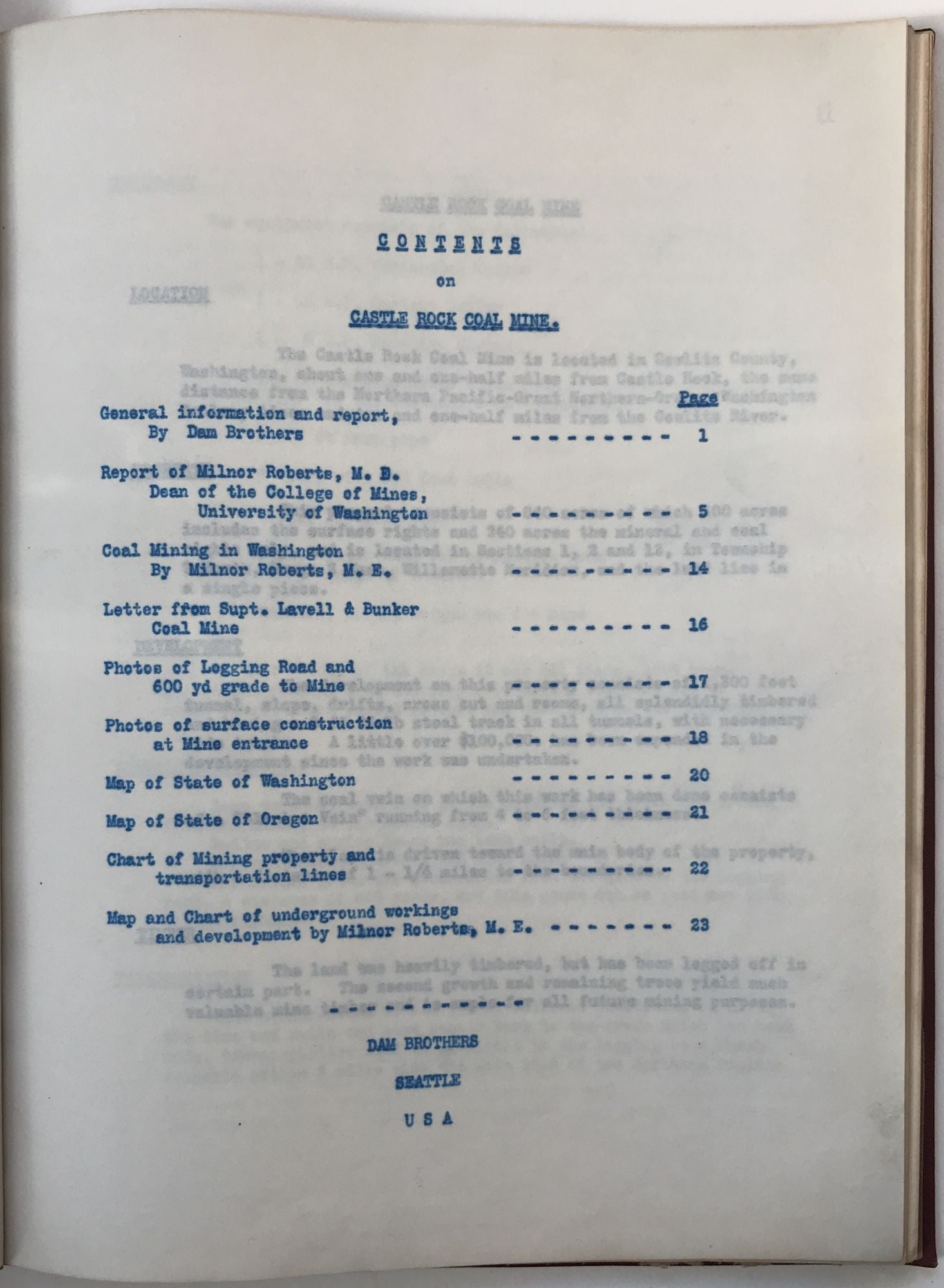
Typescript report prepared by Dam Brothers of Seattle outlining the property and potential for development of the Castle Rock Coal Mine in Cowlitz County, Washington. The 840-acre property was located near the town of Castle Rock, which is between Olympia and Portland, near the Oregon border. "The development on this property consists of 1,300 feet tunnel, slope, drifts, cross out and rooms, all splendidly timbered and having 3 ft 24 lb steel track in all tunnels, with necessary side tracks. ... The coal vein on which this work has been done consists of a 'Blanket Vein' running from 4 to 6 feet thickness." The report appears to have been prepared as a sales prospectus, and seems to indicate that the mine has been inactive for some years. It includes the mine details, a report on the mine by Mining Engineer Milnor Roberts, and five photographs of the area around the mine entrance. Additionally, there are general maps of Washington and Oregon, as well as a folding township map on which the location of the mine has been drawn in by hand, and a large blueprint map depicting the tunnels and diggings of the mine itself. The Dam Brothers were involved in a number of development projects in the Yakima Valley including, ironically, irrigation and hydroelectric power. Presumed to be either unique or produced in a very small number of copies.
Price: $850.00