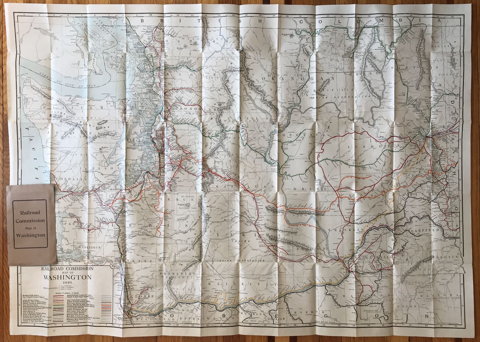
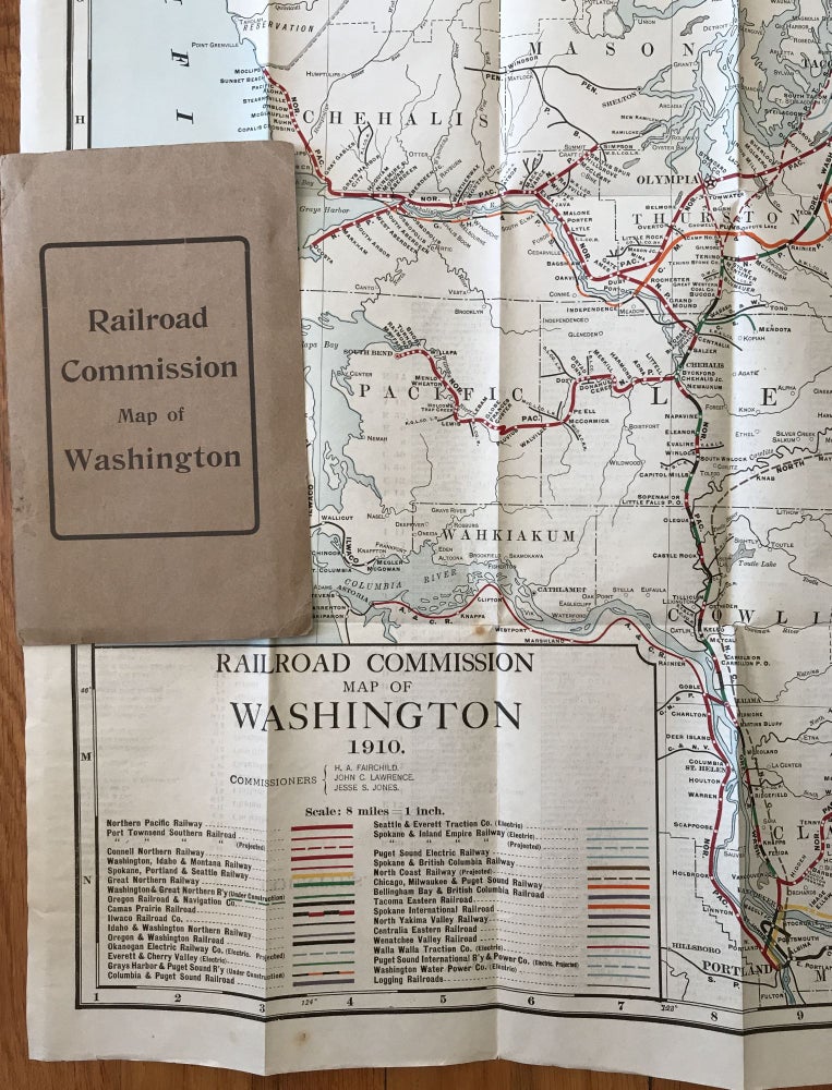
Railroad Commission Map of Washington. 1910
[Olympia: Washington Railroad Commission], 1910. Large folding map, 34 x 47.5 inches, folded to 8 x 5 inches. Original printed card covers. Covers with slight loss, minor wear. Minor wear to map, minor separation at a few corners. Very good plus. Item #1018
Large and detailed map of Washington state, delineating thirty different railroads across the state, including electric and projected lines, as well as logging railroads. The Washington Railroad Commission was first formed in 1905. Comprised of three persons, the Commission was tasked with inspection, safety, and some regulation of rates, as well as investigation into complaints of misconduct. It produced three maps, in 1908, 1910, and 1911, reflecting the swiftly-evolving landscape of transportation in the state. The following year, the Commission was redesignated as the Washington Public Service Commission, and its jurisdictional role expanded to encompass electric, gas, telephone, and more. Among the railways listed here are the Northern Pacific; the Spokane, Portland and Seattle Railway; the Columbia & Puget Sound Railroad; Ilwaco Railroad Co.; Tacoma Eastern Railroad; the Wenatchee Valley Railroad; the Centralia Eastern; and the Northern Yakima Valley Railway. There are seven electric railroads listed: Okanagan Electric Railway (projected); Everett & Cherry Valley; Seattle & Everett Traction Co.; Spokane & Inland Empire; the Walla Walla Traction Co.; Puget Sound International Railway & Power Co.; and the Washington Water Power Co. The verso of the map contains an index of towns, as well as logging, coal, and iron companies. Only a handful of copies recorded in OCLC.
Price: $650.00